
What is Google Earth?
Google Earth is computer software that creates a three-dimensional picture of the Earth using satellite photos. The program maps the Earth by superimposing satellite photos, aerial photography, and GIS data onto a three-dimensional globe, allowing users to view towns and landscapes from multiple perspectives. Users can use a keyboard or mouse to explore the globe by entering addresses and coordinates.
The program can also be downloaded and navigated using a touch screen or stylus on a smartphone or tablet. Users can utilize the Keyhole Markup Language to add their data and upload it through multiple channels, such as forums or blogs. Google Earth is a Web Map Service client that can display many types of imagery overlaid on the earth’s surface.
Pros:
- Free
- Satellite data and pre-built tours are included in the incredible level of information. Take screenshots and upload maps.
- It’s available on a variety of platforms.
- Maps and data that are up to date
- Exceptionally detailed
- Three-dimensional capacities
- There are more layers available.
- Select buildings can be “visited.”
- A historical perspective
- It’s possible to incorporate it into web pages.
- It is available in 45 different languages.
Cons:
- To get the optimum performance, you’ll need a lot of bandwidth.
- In some regions, the resolution is low.
- Internet access is required.
- Some portions of the globe are not covered, and others are restricted.
- On maps, less developed countries are poorly represented.
- To improve accessibility, more audio functions are needed.
Best 10 Google Earth Alternatives
1. Zoom Earth:
Zoom Earth is the finest Google Earth alternative since it provides excellent imagery of the Earth without relying on Google’s services. Instead, it’s entirely a web-based service that displays real-time updates on fires, storms, weather, and other data, just like any other service. It lets you zoom in on maps with high-resolution aerial views of many of the locations depicted in the image. You can also see photographs of a location’s history. As a result, you should think of this wonderful service as one of the greatest Google Earth alternatives.
Features:
- Real-time weather visualization using radar photos of rain and wind speeds.
- A quick, zoomable weather map featuring live satellite photos from around the world.
- You can learn about storms, volcanoes, earthquakes, and other natural disasters.
2. QGIS:
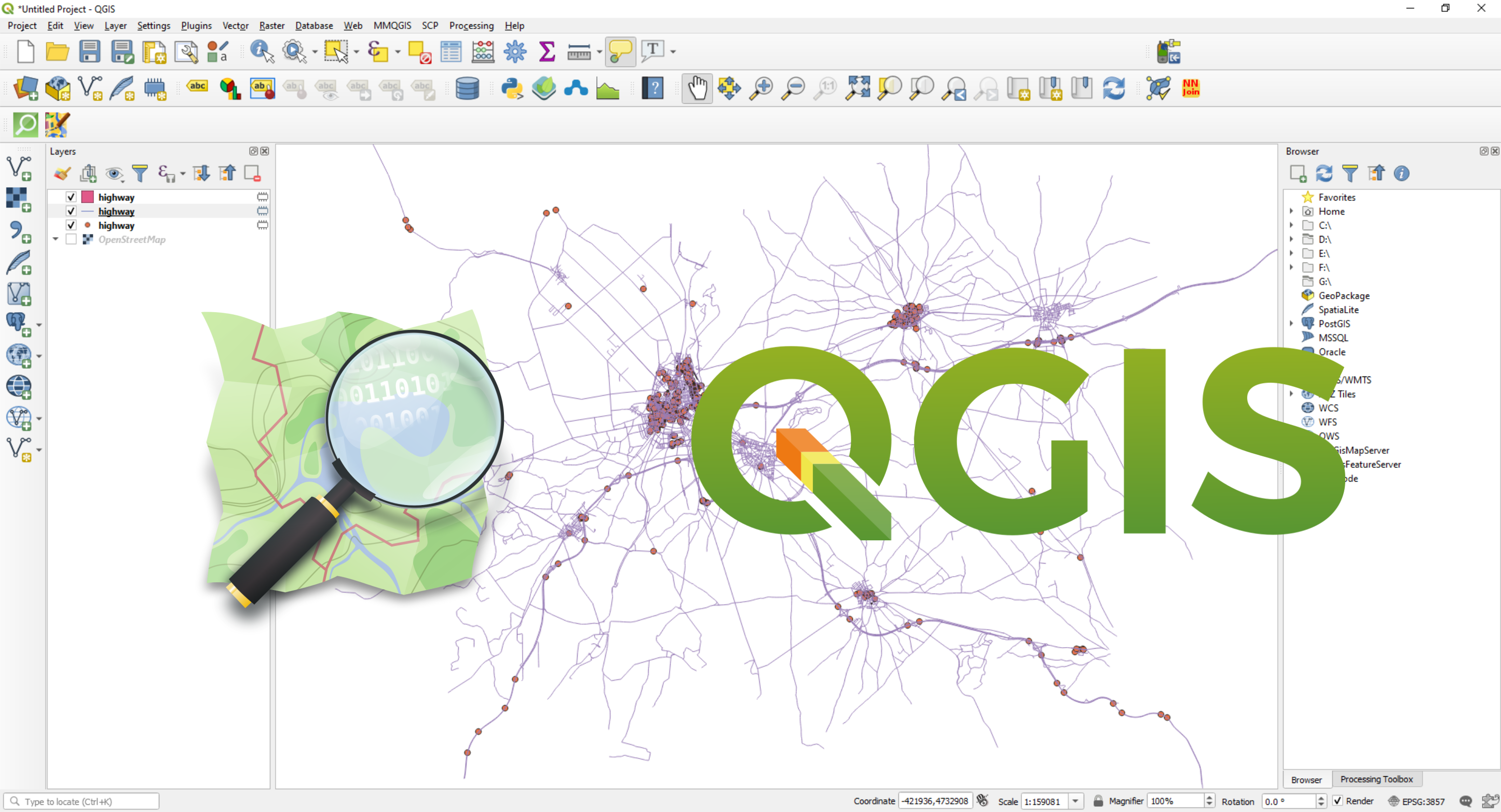
QGIS is an excellent tool for improving geographical visualization and analysis. Furthermore, it is an open-source software program that allows for geospatial analysis, data viewing, and modification thanks to contributions from technical specialists all around the world. So, in my opinion, if you’re searching for software that can easily replace Google Earth on your PC, this is the way to go. Nonetheless, QGIS has the advantage of being a vector-based tool, which means you can draw any geospatial data you want in it.
No matter how much you zoom in with QGIS, the terrains and maps will always appear nice. You can also use QGIS 3 to digitally modify Google Earth, Google Terrain, Google Maps, Google Satellite, and other Google products.
Features:
- Almost any vector or raster GIS data format is supported by QGIS.
- The database can be managed without using SQL.
- The user interface is simple.
- Visualization and modeling in three dimensions.
- Python has been included.
3. AutoCAD Map 3D:
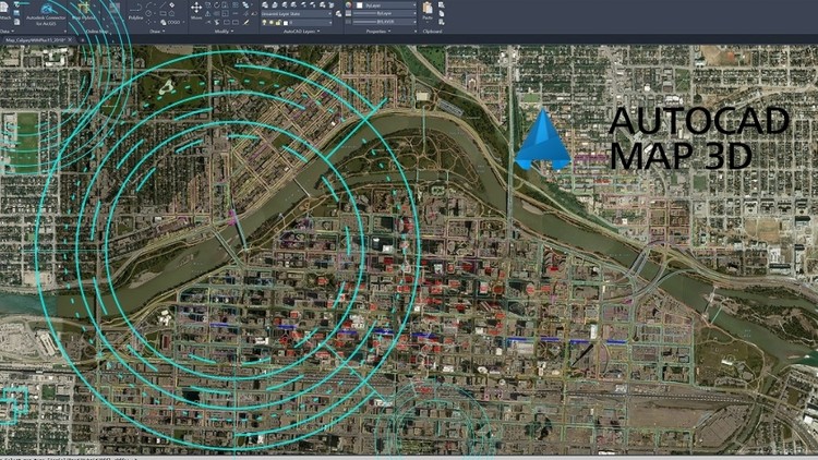
AutoCAD Map 3D is a user-friendly GIS software made by Autodesk, as the name suggests. GIS mapping with this application is a terrific approach to boost your business. It’s also incredibly handy because you can integrate topographic characteristics from GIS and CAD data to generate models for study. In terms of engineering design and geography, it bridges the gap between CAD and GIS. The ability to construct thematic maps is AutoCAD Map 3D’s key advantage over Google Earth. However, you must first acquire this product from Autodesk’s official website, as they do not provide any free services.
Features:
- Tools for editing, COGO, and topology are all included in one package.
- Mapbooks with index grids covering various themes.
- Autodesk users will appreciate this.
- Surface point clouds and LiDAR data are included.
- An interface that is logic-based.
- Integration of CAD and GIS.
4. MapInfo Pro:
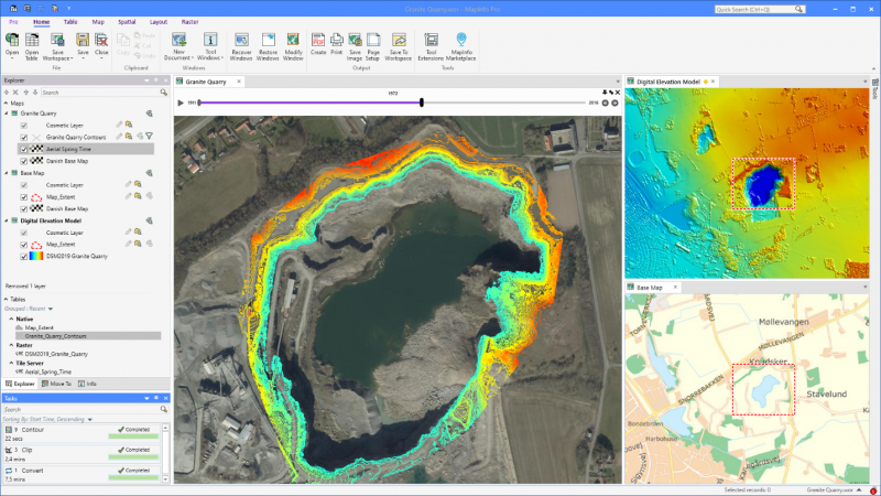
Precisely produces the MapInfo Pro desktop GIS tool, which is used to map and analyze geographic locations. This GIS program is used by many professional geospatial analysts. You may examine thematic maps, alter raster data, perform geographic queries, and, if necessary, generate maps all in one spot using this software.
It’s also 64-bit software that’s well-suited to Windows users. If you’re a Windows PC user seeking some of the top Google Earth alternatives, MapInfo is a good option. It also comes with a 30-day free trial, allowing you to try it out before deciding whether or not to buy it.
Features:
- Data visualisation options
- Location intelligence that is integrated.
- Analysis of raster data using GIS.
- Data is created and edited.
- Allow data to be shared.
5. ESRI ArcGIS:
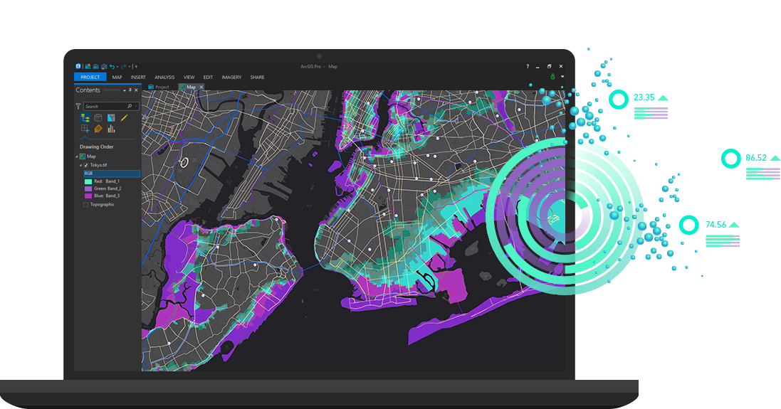
ESRI’s ArcGIS software includes all of the components needed to extract and manage information from images and remote sensing data. However, it also has imagery tools for maintaining workflows for visualizing and analyzing large amounts of data. Despite intense competition from a plethora of competitors for open source and commercial GIS tools, ArcGIS remains one of the most extensively used GIS software packages, despite its long history.
ArcGIS has a wide range of applications, including navigation, engineering, transportation, geology, and more. As a result, ESRI ArcGIS is one of the greatest Google Earth alternatives in my opinion.
Features:
- Data hosting services are provided.
- Statistics on the population.
- Data analysis
- Geocoding and searching
- Getting directions and routes
- An examination of the geographical situation.
6. ArcGIS Earth:
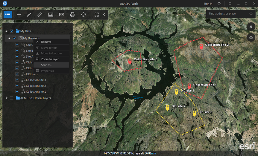
ArcGIS Earth is a 3D interactive map that may be used to plan, visualize, and evaluate events all around the world. This free and simple-to-use application, on the other hand, allows for better decision-making without relying on the Internet. ArcGIS Earth’s biggest feature, in my opinion, is the ability to import data from other ArcGIS products, such as the ArcGIS Living Atlas, ArcGIS Online, and so on. So, no matter what platform you use (Android, iOS, or Windows), you may download their official software and access the next-generation features that Google Earth does not offer. As a result, it’ll be one of the best Google Earth alternatives available online.
Features:
- It delivers situational awareness for enhanced decision-making on desktop and mobile devices.
- It can read data in a variety of forms, including 3D Earth models.
- In ArcGIS Earth, KML editing procedures are supported
- It’s completely free to use.
7. Global Mapper:
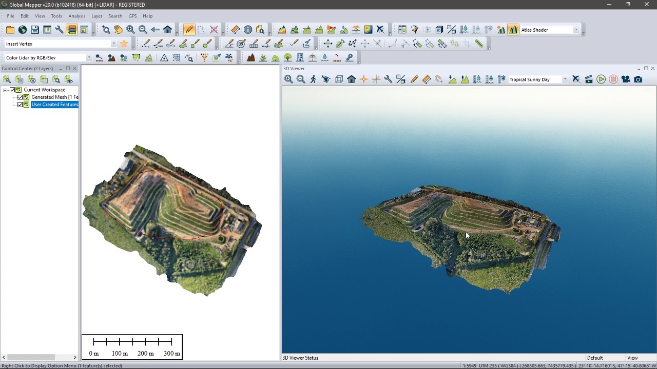
Blue Marble Geographics created the GIS software Global Mapper. You can use this application to visualize, edit, and analyze Lidar and point cloud data in any format. The software not only supports point clouds of nearly any size but also includes tools for assessing the data. Unfortunately, the free version lacks several features compared to the pro version.
To gain access to the comprehensive collection of tools for editing, producing data, doing complex 2D and 3D analyses, scripting for process automation, and many other premium features, you must acquire the Global Mapper Pro.
Features:
- Data can be imported and exported.
- Data is accessible via the internet.
- An easy-to-use UI.
- Automating.
- Rendering in three dimensions.
- Analysis of the topography.
- Mapping and posting on the web.
8. 2GIS:
2GIS is essentially a directory with a map and navigator built-in. One of the most intriguing aspects of this directory is that it may be accessed without an active Internet connection.
However, to use that feature, you must first download the database for the city or region in question, then use it on the plane, subway, or wherever you are traveling. 2GIS has information on over 180 cities, 1.5 million businesses, and driving and public transportation instructions. So, I believe this could be a good Google Earth substitute, but it all depends on your requirements.
Features:
- There are around 42 million monthly active visitors on the site.
- 2GIS is available for free on 2GIS.com, the AppStore, and Google Play.
- There is no need for an Internet connection.
- More than 180 cities are represented in 3D maps.
- Navigation and mapping when offline.
9. NASA World Wind:
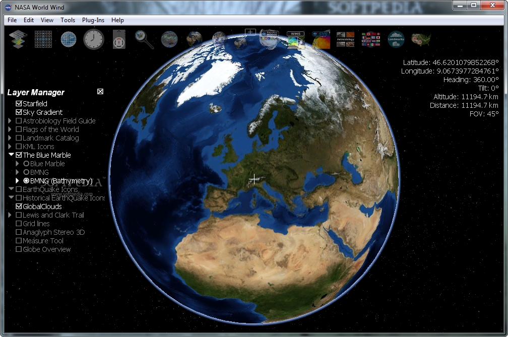
World Wind was created by NASA in 2003 as a community-based open-source virtual globe for wide public usage. The World Wind is based on the.NET Framework, which is only compatible with Microsoft Windows. The more recent Java version of World Wind, on the other hand, Java allows for cross-platform compatibility. So, what makes you think this can supplant Google Earth? This application, in comparison to the Google Earth Map, overlays NASA and USGS satellite photos, aerial photography, topographic maps, Keyhole Markup Language, and Collada files.
Over Google Earth, The World Wind has the added benefit of NASA wizardry. As a result, you can consider it because it is completely free to use and there are no hidden fees.
Features:
- Create 3D virtual globes with the SDK and API.
- 3D geography may be easily integrated into any program.
- Windows, Mac OS X, and Linux are all supported.
- An initiative by the government.
- Licenses for development and runtime are both free.
- Unrestricted use on a variety of devices.
- NASA’s servers have produced some stunning photographs and terrain.
10. Maptitude:
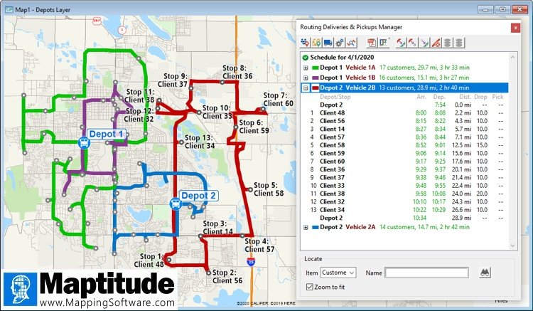
This type of GIS permits the widespread usage of mapping software. Geographic data, on the other hand, can be handled, shared, and analyzed by several individuals at the same time utilizing this approach. Furthermore, this desktop mapping software comes with several useful functions. For example, it includes a slew of new and improved tools that make building and altering maps a breeze.
Furthermore, the maps can be customized with your data, allowing you to evaluate the geographic information of specific places. That is, however, why this software easily earns the top spot in our list of recommendations.
Features:
- Find out where your clients are at any given time.
- Keep track of your sales by location.
- Find innovative ways to make money.
- Analyze trends and patterns in spatial data that spreadsheets and databases can’t hide.
- Transparency may be used to control most features on a map.
- Images serve as the basis for icons.
- Determine which geographical issues have an impact on your company.
Conclusion:
As with every technological installation, there is a risk of not having enough time or the right tools to achieve the desired results. Google Earth is vulnerable to these hazards, but its user-friendly interface and powerful yet simple features assist to mitigate them. The capacity of pupils to utilize deductive logic to derive conclusions aids in the development of analytical skills, and the tool’s use also aids literacy development by demanding written explanations of observations.


